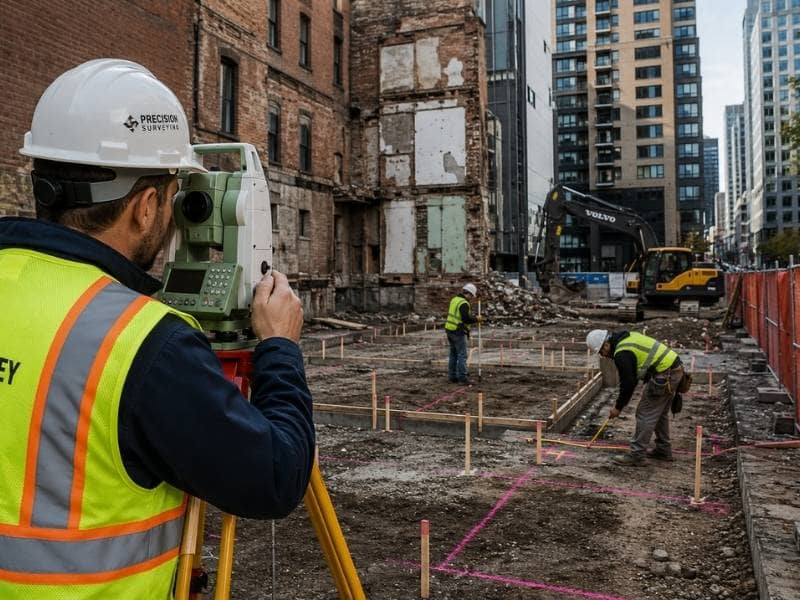
Old industrial land often carries more history than a first walk can show. Rail spurs, old utility lines, and manufacturing access routes may no longer be in use. Yet the legal rights tied to them can still exist on paper. An ALTA survey is built to pull this kind of information together. It compares what the title records show against what the property looks like today.
Buyers and lenders need more than a simple boundary check on this kind of deal. They need to know if an old easement could limit future construction. They also need to know if a stretch of pavement they assumed was theirs actually belongs to a neighbor. This survey is made to find those answers.
Reading Title Exceptions Through the Site’s Industrial History
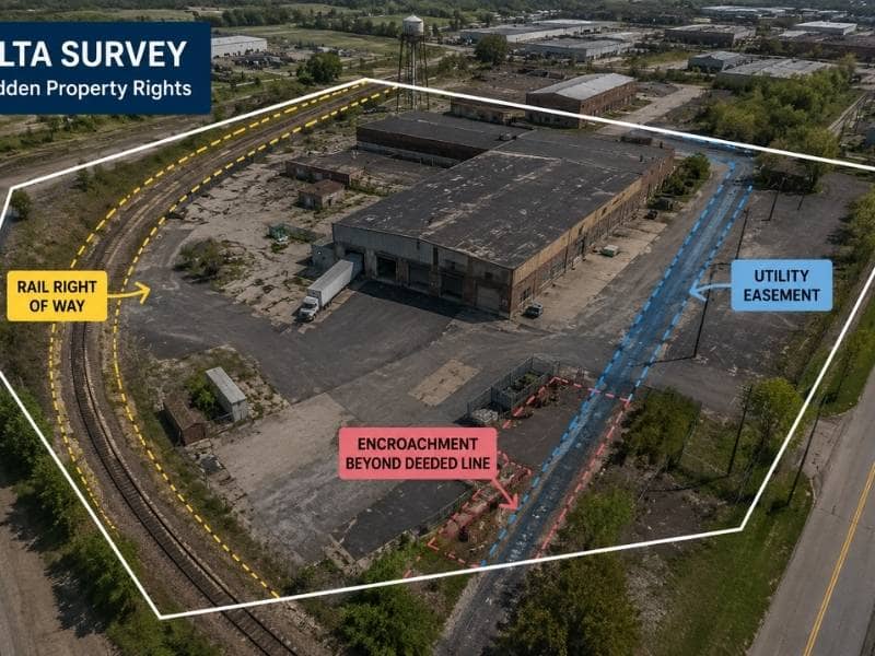
Title papers on old industrial land often list items that go back decades. A right of way for a rail line that has not carried a train in years might still sit on the title. Old utility deals can name equipment that was removed long ago.
None of this is strange for a site with a long industrial past. But it takes careful reading. Surveyors work through each item listed in the title report. They check which ones can be tied to a real spot on the ground, since even a right with no clear location still needs to be noted in the final drawing.
Connecting Recorded Corridors to Present-Day Improvements
Once an old title item is found, the next step is placing it against the property as it looks now. A recorded rail path might sit under a parking lot today. A utility easement might run partly beneath a building addition put up years after the easement was granted.
This step matters because a buyer needs to know if current buildings sit inside an area where use could someday be limited. Placing old rights next to buildings, pavement, fences, and visible pipes or poles gives everyone in the deal a clear view of where paper rights and real construction actually meet.
Finding Occupations That Do Not Follow the Deeded Limits
Industrial land tends to gather improvements over time. Not every addition respects the original lines. Storage areas, loading docks, fences, and even parked equipment can spill past a deeded limit for years without anyone noticing.
A field survey checks for this directly. The crew walks the property and compares what is really there against the recorded lines. Finding a problem like this before closing gives buyers a chance to fix it, whether through talks with the neighbor, a written agreement, or simply weighing it into the purchase price.
Reviewing Access From Public Roads to Interior Operations
A site can have legal access on paper that does not match how trucks and workers actually move across it. This gap shows up more on industrial land, where roads and loading areas were built for daily needs, not to match the exact recorded access point.
Checking this means tracing the route from the nearest public road into the middle of the site. Then that route gets checked against what the title papers actually say. A mismatch here does not always cause trouble, but it is worth flagging before a new owner finds the issue during their own work.
Flagging Matters for Legal and Transactional Review
An ALTA survey shows facts. It does not settle who owns what or fix a dispute. When a surveyor finds a conflict, whether an encroachment, a fuzzy easement, or a line that does not match, that finding gets marked on the drawing and passed to the deal team.
Lawyers, title firms, and lenders then decide how to handle it. This split keeps the survey focused on things that can be measured, while legal calls stay with the people trained to make them.
Frequently Asked Questions
Can an ALTA Survey remove an obsolete easement?
No. It can show where the easement sits on paper, but a separate legal step is needed to change or cancel it.
Are abandoned utility lines always located?
Not always. Their location depends on the records that exist, what can be seen on the surface, and the scope agreed to for the survey.
Will environmental contamination appear on the survey?
An ALTA Survey is not an environmental study, though features that hint at a concern may still be shown on the drawing.

 Land Surveyors are professionals who make precise measurements to determine the size and boundaries of a piece of real estate. While this is a simplistic definition, boundary surveying is one of the most common types of surveying related to home and land owners. If you fall into the following categories, please click on the appropriate link for more information on that subject: